

An Chailleach [Bencullagh]
Good walks are even better shared.
Overview
An Chailleach [Bencullagh]
Overview
An Chailleach, also known as Bencullagh, is a charming Marilyn located in Northern Ireland's Sperrin Mountains. With an elevation of 601 meters, it offers hiker-friendly terrain and stunning vistas that make it a worthwhile addition to any outdoors enthusiast's list.
Geology
The mountain's geology is primarily granite and schist, remnants of the ancient Caledonian orogeny. These rocks form a robust foundation for the landscape while adding dramatic features to the terrain. If you're keen on geology, this region serves up a fine slice of earth history!
Routes
The Bencullagh Circuit is a well-trodden path that brings you onto the mountain’s flanks and up to the summit. At 8.5 km long and taking about 3 hours, it strikes a great balance between challenge and leisure. Make sure to pack some snacks, because, let's face it, your stomach's gonna start grumbling!
Summit Features
Once you reach the summit, you'll encounter a sturdy cairn, a welcoming sight for weary legs. It's the perfect place to have a sandwich and take in the expansive views.
Terrain
The mountain's terrain consists mainly of grassy slopes, interspersed with rocky outcroppings that can provide a bit of a challenge. Be prepared for muddy conditions if you’ve picked a rainy day—good hiking boots are a must!
Views
Oh, what views await you! From the summit, you're treated to a panorama that takes in the Mourne Mountains and stretches towards Lough Neagh. For the best visual feast, try visiting in spring or autumn when the skies are most cooperative. A sunrise here is truly a sight to behold!
Hazards
While the hike is generally safe, slippery paths and steep sections demand respect. And let’s not forget the weather—it can change quicker than you can say ‘An Chailleach’. So, prepare accordingly!
Nearby Summits
Besides An Chailleach, nearby peaks such as Loughsalt Mountain and Crockbrack provide great options for further exploration.
Access
Parking is available at the Bencullagh Forest trailhead, but be forewarned—spaces are limited! If you’re relying on public transport, plan for a short taxi ride from Cookstown. Either way, don’t forget your picnic essentials!
Facilities
While there are no facilities on the mountain, the nearest town, Cookstown, has cafes and public toilets to refresh you post-hike. Always handy for a nice cuppa!
History
The mountain’s name translates to ‘The Old Woman’ in Irish and is rich with local folklore. There are tales of giants that once roamed the area, which might just make your hike a touch more thrilling!
Don't miss this hidden gem nestled in the Sperrin Mountains!
Happy hiking!
Explore routes near An Chailleach [Bencullagh]
Public walks starting within 80 km of this hill. Nearby does not mean a route reaches the summit; check its map and access before setting out.
No public routes are currently listed within 80 km of An Chailleach [Bencullagh] on Walkmates. This does not mean there are no paths here. Explore the map and check local access information before planning a walk.
Route planning notes
These notes describe possible approaches, not verified navigable routes or permission to cross land. Check current paths, local access rules and conditions before setting out.
Bencullagh Circuit
A popular circular route that offers a scenic approach to the peak, winding through heather and grassy slopes.
Make a day of it, together
Find someone to share the walk with, or organise a day out along a route you like.
Photo Gallery
View all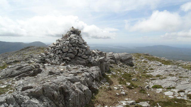 Photo could not load
L7553 : Summit cairn on Bencullagh with view NW towards Letterfrack
Colin Park
Hill facts and local notes
Classifications
Elevation
634m
2,080 ft
Prominence
158m
Coordinates
53.5187, -9.8778
L755537
OS Map
37
At the Summit
At the summit, you'll find a small but sturdy cairn, providing a reliable landmark in the often misty conditions. It's a perfect spot to take a breather and enjoy the views.
Terrain & Geology
The area is primarily composed of granite and schist, providing a rugged but stable foundation. The geology dates back to the Caledonian orogeny, which shaped much of the landscape you see today.
Views & Scenery
From the summit, gaze out towards the majestic Mourne Mountains and the rolling landscapes of County Tyrone. On a clear day, you might even spot Lough Neagh to the south.
History & Heritage
Name Origin
The name 'An Chailleach' translates to ‘The Old Woman’ in Irish, often linked to local folklore.
Historical Significance
The area is steeped in myth, with stories of ancient giants that supposedly roamed these hills.
Getting There & Facilities
Check current local access restrictions, parking rules and transport timetables before travelling. These notes do not confirm public access to the summit.
Parking
The nearest parking area is at the Bencullagh Forest trailhead, accessible via a minor road south of the peak. Spaces are limited, so arrive early!
Public Transport
Bus services operate from Cookstown to surrounding areas, but a short taxi or private vehicle is recommended to reach the forest trailhead.
Nearby Facilities
There are no facilities on the mountain itself, but Cookstown offers cafes and public toilets for post-hike refreshments.
Safety Information
Known Hazards
- Muddy paths and steep sections may pose risks, especially after rain. Be cautious of sudden weather changes in the area.
General Safety Tips
- Check weather conditions before setting out
- Carry appropriate clothing and equipment
- Let someone know your planned route
- Take a map, compass, and GPS device
- Carry emergency supplies: food, water, first aid kit, torch
Hills
Some common questions about the hills answered
Are there group walks up An Chailleach [Bencullagh]?
Many walkers use Walkmates to join or organise walks with others. You can check for group walks around An Chailleach [Bencullagh] through the maps
Are there other walkers around An Chailleach [Bencullagh]?
Activity varies by location and time, but Walkmates lets you see whether others have shared walks or shown interest in this area. Find other people through the walking friends search walking friends for An Chailleach [Bencullagh] search or of course create your own walk for An Chailleach [Bencullagh]
Can I organise a walk to An Chailleach [Bencullagh]?
Yes. If there aren’t any walks listed already, you can create a walk and make it available for others to join.
If you're signed up to Walkmates, you can create a walk to An Chailleach [Bencullagh].
How do I find a walk up this hill?
There are often multiple ways to walk this hill, depending on experience and route preference. Walkmates helps you explore walks and routes that others have shared.
Can I suggest a new route up An Chailleach [Bencullagh]?
Yes. You can suggest or create routes to share with others. Walkmates focuses on the social side of walking, so routes are used to help people organise walks and explore areas together, rather than as detailed navigation tools or route libraries.
Other uses really appreciate knowledgeable walkers sharing their routes. Share your favourite route to An Chailleach [Bencullagh] here
The is an error or something incorrect about this hill. How do I let you know?
We always strive to keep the information on Walkmates as accurate as possible. If you find an error, please let us know through the contact form and we'll aim to correct it as quickly as possible
Community Discussion
Comments
Location
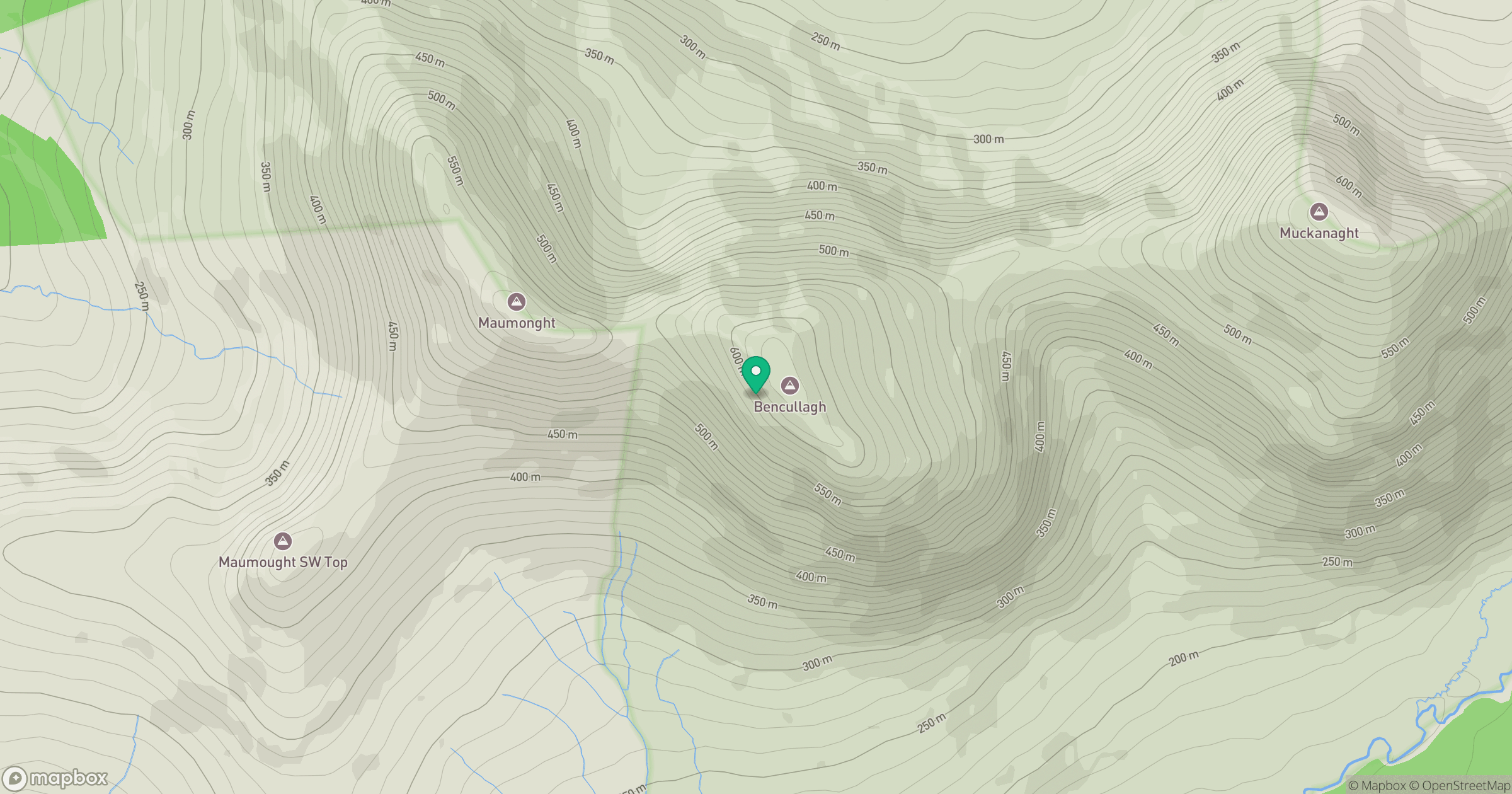
Grid reference: L755537
View on OpenStreetMapOpens a map in a new tab, centred on the hill.
Hills within 30 km
Straight-line distance, not a walking route or confirmation of access.
Mweelrea
814m
Mucanacht [Meacanacht] [Muckanaght]
655m
Benbrack [Binn Bhreac]
584m
Benbaun
729m
Binn Bhraoin [Benbreen]
692m
No comments yet. Be the first.